Wednesday, May 28, 2014

The Secret Value of Mooring Fields - reflections from Emerald Bay


Like a game of tick-tack-toe, dozens of empty mooring buoys floated in Emerald Bay.

It is an ugly aesthetic - little white balls in orderly rows breaking up the natural beauty. This is my perception, because I'm used to unspoiled anchorages in the other islands.

But herein lies a secret beauty: without a mooring area, all those boats would normally have to drop their anchor and chains, ripping up chunks of reef as the rode swings. If it's a reef, the damage done by dozens of boat anchors on the ocean floor is not trivial.

Therefore the mooring field serves the dual purpose: convenience to boaters and protecting the marine habitat. It allows a large number of boats to visit with minimum impact.

It's a strange conundrum... on the one hand, my perception is that it gives Emerald Bay a stale, "mass-tourism" feel; on the other hand it keeps the marine environment more healthy, and hence preserves its beauty.

It's a case where my subjective opinions are negative, but the overall objective value is positive. Must overlook some perceptions in favor of the underlying value, at times!

Fences protect native species, mooring fields organize boats, and rules keep invasive species from migrating; all which seem un-natural and limiting. But those limits may create a greater life force in the area and enhance its aliveness.


Wednesday, May 21, 2014

What if Catalina Island could talk?

Risso Dolphins, with characteristic scar patterns on their bodies, seen 1 mile from Avalon harbor in Catalina.
They measure 8-12ft, much heftier than bottlenose dolphins!

What if Catalina Island could talk to you, like an old grandmother sitting under an oak tree?

"Ms. Catalina, I beg your pardon, but what do you want for your future?" you might ask.

"Well, my son, back in the day..." Ms. Catalina would start.


We were anchored north of Avalon near of the summer camps. I thought, for sure Ms. Catalina likes having all these kids around. That is way cool - they are snorkeling, playing, and appreciating her shoreline and canyons.

Ms. Catalina also likes having a few bison roaming around, brought to the island by that one famous movie production. It makes her feel unique. She likes how the island fox is coming back, after nearly being wiped out by a mainland disease. Hey, she even likes having the pretty town of Avalon -- although when their sewage system is leaking and the gas powered golf carts are making noise (as they do daily) she gets a little disgruntled.


Ms. Catalina is as happy and healthy as any other grandmother -- it depends how alive she feels. This is true for any living being - after all, being feeling "alive" is what makes them a "living" being!  If you wonder whether an island is alive or not, think about how much life is pulsating on Catalina.

How alive we feel, or aliveness, directly relates to our health and happiness. Then why is it not well measured in our health system? The same is true for ecology. Maybe aliveness should be measured?

If I had to guess what makes Ms. Catalina feel more or less alive, it's probably similar to what makes me feel more or less alive. That is a hypothesis which I wanted to investigate as I cruised the islands.


Playful barbed wire at the top of Two Harbors, Catalina Island


Wednesday, February 19, 2014

Stroke Victims and Islands -- reflections on recovery

Navy facilities on San Clemente Island

Like a middle aged man recovering from a stroke, restoring an island that was eaten up by goats or iceplant is physically demanding. But more-- it brings up deep existentialist questions, which aren't often addressed. 

Our tendency is to go into battle and fixate our resources with singleminded focus --  but if we stopped to ask our bodies or lands what they actually need, would we get different answers?  There are two voices competing for attention:


The Environmentalist Voice
The stroke victim wants to be able to run and swim like he did in the past, at all costs. He wants to preserve his limbs and youthfulness. This is like the voice of the environmentalist, who harkens to the past; determined to restore native habitat and protect species from withering away. He considers wellbeing of nature is intrinsically important, and tied in with the future wellbeing of humans. 

The Conservative Voice
The stroke victim begins to think he should "just move on" to new hobbies and pursuits, and not worry about re-living his past. He wonders if months of physical therapy and special diets are a waste of time - he could just enjoy the life he has. This is similar to the voice of the conservative, who prioritizes progress and moving forward. He thinks spending millions of dollars on restoration is a waste, since it could be allocated to more immediate human uses, not vague ecosystem benefits. 


A Holistic Approach?
The voices seem to contradict one another, but it is in their union that lies strength. 

The environmentalist voice is past driven. It is important because even if we are single-mindedly trying to protect a small salamander which thrived 50 years ago, the benefits expand in multiple ways: better stream water quality, better hiking opportunities, better erosion control, better habitat for other species, etc. The stroke victim, similarly, may not be able to run again like when he was young, but exercising and a good diet will improve his overall health and quality of life. 

The conservative voice is future driven. It is important because accepting new conditions and focusing on immediate human needs prevents stagnation; it keeps the creative force of society moving and improving. Sometimes dumping millions into a stream restoration with bulldozers and delicate natives leads nowhere. Likewise, the stroke victim doesn't want to be forever frustrated that they can't be young again-- moving on with life and cultivating a good attitude is central component to wellbeing. 

The strange thing is that both voices are concerned with our wellbeing -- but employ different perspectives. Every stroke victim needs to listen to his/her own body and limitations at each step of the way, with one foot in the conservative future, and one foot in the environmentalist past.  The recovery of Islands is the same. At the heart of the problem is that we don't tend to listen to what our bodies and lands needs; if we did, we'd hear both voices echoing. 

 If I could talk to the island, what would it really want? How does one listen to islands, or our own bodies, for that matter? How do we figure out the holistic approach to recovery?  These are the mysteries that I set out seeking.
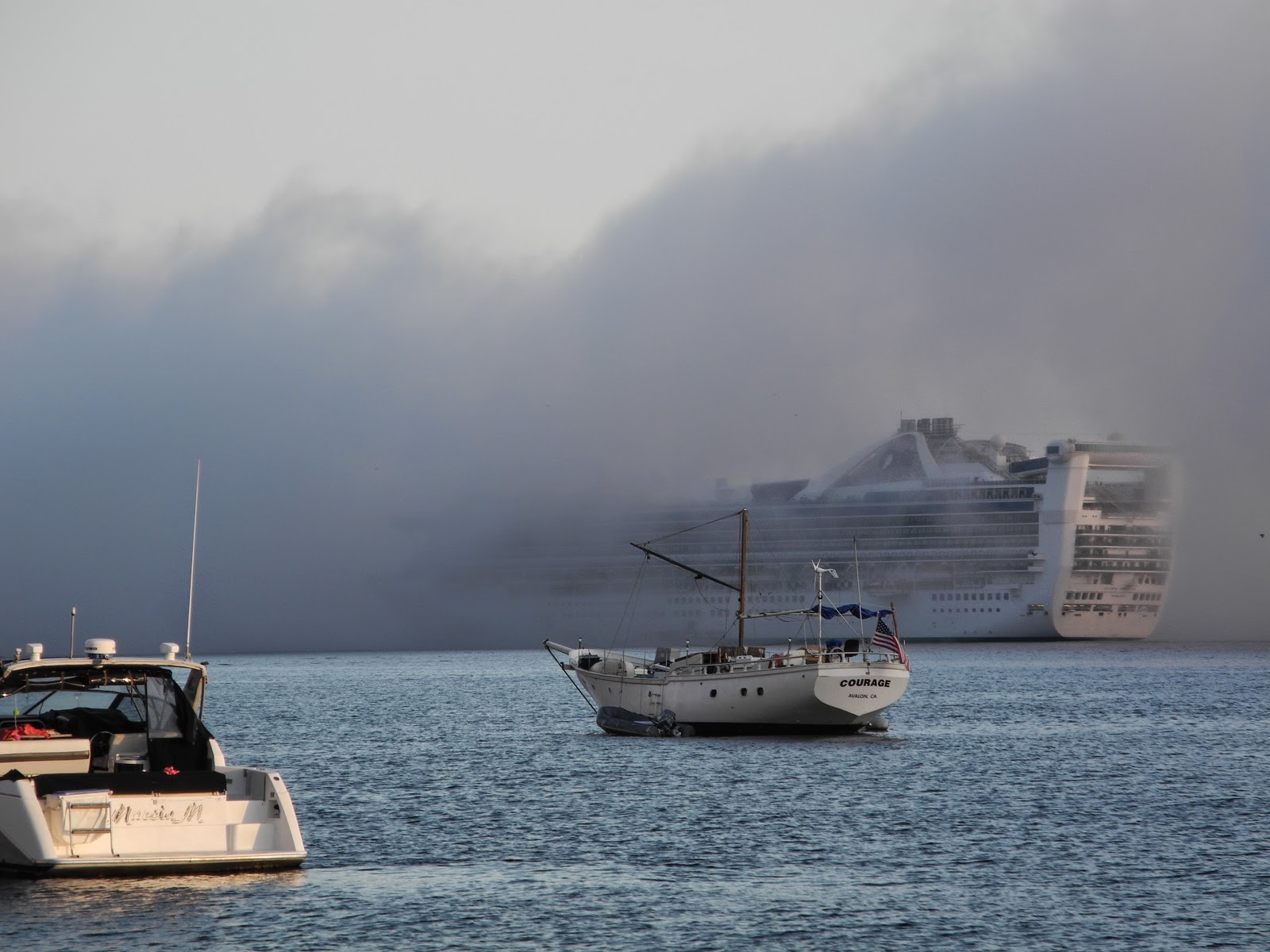

Different crafts co-existing, as the fog rolls into Avalon anchorage, Catalina Island


Wednesday, January 22, 2014

Circumnavigating San Clemente Island, part 3


Day 3. 

"Don't anchor anywhere on the east side, you'll put a hole in your boat," said a few lobster guys. "It is deceptively calm and you'll just drive into a rock."

We wanted to spend a night on the lee side of the island. It is a 15 mile expanse of unchanging, flat, intensely bold coastline. Why bother trying to anchor for the night? To get a better feel for the island, the land and its cultural history, I wanted to spend time in that side. Plus, we wanted to break up the 38nm return trip to Avalon, which is a long haul at 6 knots. 
But... the chart shows deep water (100ft+) right next to the cliffs for miles on end. Brian Fagan's cruising guide listed no anchorages. The locals lobstermen advised us against it. The prospects were glum.  

Then we came across this book:  
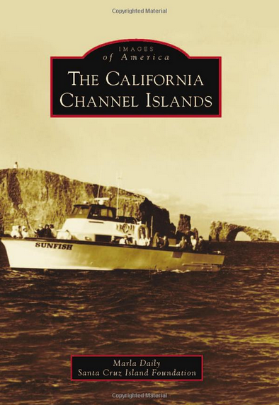
In "The California Channel Islands", author Marla Daily relates the fascinating history of pioneer ranchers, entrepid businessmen, and hermits.  We read about a German man who lived alone on the east side of San Clemente island for 30 years around the turn of the century. He had a fish camp for anglers and would do tours of native american artifacts. He lived at "Mosquito Cove". That is where we should go. If people visited him regularly, I figured, there must be a good landing site; possibly even a sandy beach. 
The coastline was eerie. The entire east side of the island is a blank wall of cliffs with flat water like a lake. Rocks near the surface show no indication of their presence, through ripples or otherwise, because the sea is so calm. Hence the warning of the lobstermen.  


We found Mosquito Cove by GPS - there was hardly any geographic feature to distinguish it. There was in fact a small cobblestone-sand beach on the shore. We approached with the depth sounder carefully; luckily the visibility was excellent and our watch on the bow could warn of shallow reefs that protruded out of the depths. We anchored in 55ft of water, with just enough distance to shore for our boat to swing. 

Robby with a casserole of chicken enchiladas for lunch
It was ominously silent and strangely claustrophobic. With their mass, the cliffs seemed to dampen any sound -- creating the type of quiet anxiety one might have felt stuck in the still airs of the doldrums while crossing the Atlantic under sail. The ravines cut deep into the land; we imagined the German man living here for decades, and it made me shiver. 

Sunrise anchored at Mosquito Cove
Day 4.

We motored back towards Wilson Cove, where the main Navy base is located (keeping a safe distance of 3nm). Fortified ships drove into the harbor. Trucks drove in meandering roads in the distance, with barracks lining the hillside.

The Northwest anchorage was closed for Navy activity; so we hoisted sail and crossed the channel back to Catalina. We'd have to return to see that last piece of the island, one that looked so intriguing as well.


Diving at Church Rock in Catalina on the return trip


Tuesday, January 7, 2014

Circumnavigating San Clemente Island, part 2


Like stumbling into a secret society, just before dark we found a little "village" of lobster boats anchored in the tiny cove in the West side of the San Clemente island.  Deep golden light shone on the massive cliffs.

What a dramatic setting and relief. Up to that point, I had been unsure if there would be a safe anchorage in this cove. The rocks in the chart looked dicey. Would we have to sail another 12 miles and anchor after dark in some unknown beach?  Happily, we surveyed the glassy water, set the hooks, and kayaked over to the lobster guys.


"How did you find this place??" they asked incredulous. I felt proud at following my instinct.  "I heard a rumor from a friend of a friend... I guess you don't see too many cruising boats here?"   The lobster guys grinned, as they ate steak cooked on their outdoor grill with thick BBQ sauce.

DAY 2.
The Navy's giant wind turbines lazily spun in the ridgeline as we sailed to Pyramid Cove, on the southernmost tip of the island. The huge bay is often closed for the Navy to conduct its "live firing exercises"; but the schedule showed a welcoming green for "open". With our binoculars, we could see the odd target on the beach. Large signs on the beach made it clear that landing was prohibited.

So you can have a better idea--  allow me to describe my three crew on board. 

First there is Chris, a lifeguard who is coming for the entire two months, who I described in a previous post. Chris met a few commercial fisherman guys who were dying for candy bars, and ended up  swapping two snickers bars for eight lobsters. "Best deal ever!" he said, happy out of his mind. 


DSC_0487

Second is Adam Jankhe, an artist and photog living in Santa Barbara. Intentionally using a print-film camera, he captures the dysfunctional, the trite, the majestic, and weaves it into a super-realistic view of the world. Being in this setting -- a pristine environment with Navy helicopter and bombs -- provides the sort of contrast he absolutely loves. A few of his island photos can be seen on his site.


DCIM132GOPROThird is Robby Seid, who is a traveler, fishes salmon in Alaska, and works in mechanical design. Every time he comes aboard Aldebaran he improves the boat -- whether it's the sunglass line, the guitar rack, or just a roll of non-skid tape. We met on the Oaxaca coast and I'm glad we stayed in touch.


The winds gusting off the land didn't upset Robby- he sprayed himself with soapy water to slide into his ultra-tight camouflage wetsuit. We free dove through the kelp beds with our hawaiian slings and caught a few surf perch for dinner.

We hunkered down inside the cabin as winds howled outside, and the anchor light of a large sailboat swayed behind us.


Kayaking around the west side of San Clemente island
Dolphins join us on the way to Pyramid Cove


Thursday, December 12, 2013

Circumnavigating San Clemente Island, part 1

Untitled

"PROBABLY MY FAVORITE ISLAND.  WEATHER, DIVING, ADVENTURE, AND DEALING WITH THE MILITARY!!!!!!!"  

Wrote my dad's friend a few days before we left for San Clemente Island.  He had spent time there in the 1970s, and was excited we were exploring his "old stomping grounds".  

But most of the island was closed, according to the Navy schedule.  Where could we go?


The closure zone map of San Clemente Island

Day 1.

We loaded our crew on a Friday morning in Avalon, Catalina. A light north-east wind was causing a terrible lumpiness through the waters of the normally smooth harbor. 

We snapped an air vent as we dealt with slack-then-taut mooring lines. The "parking lot" of boats was stressfully tight

Filling diesel at $7.30/gallon was no easier in the rocking fuel dock, which threatened to crack our cleats with each roll of swell. 

Leaving from Avalon, Catalina, with the Casino building behind us.

Underway at 11am. 

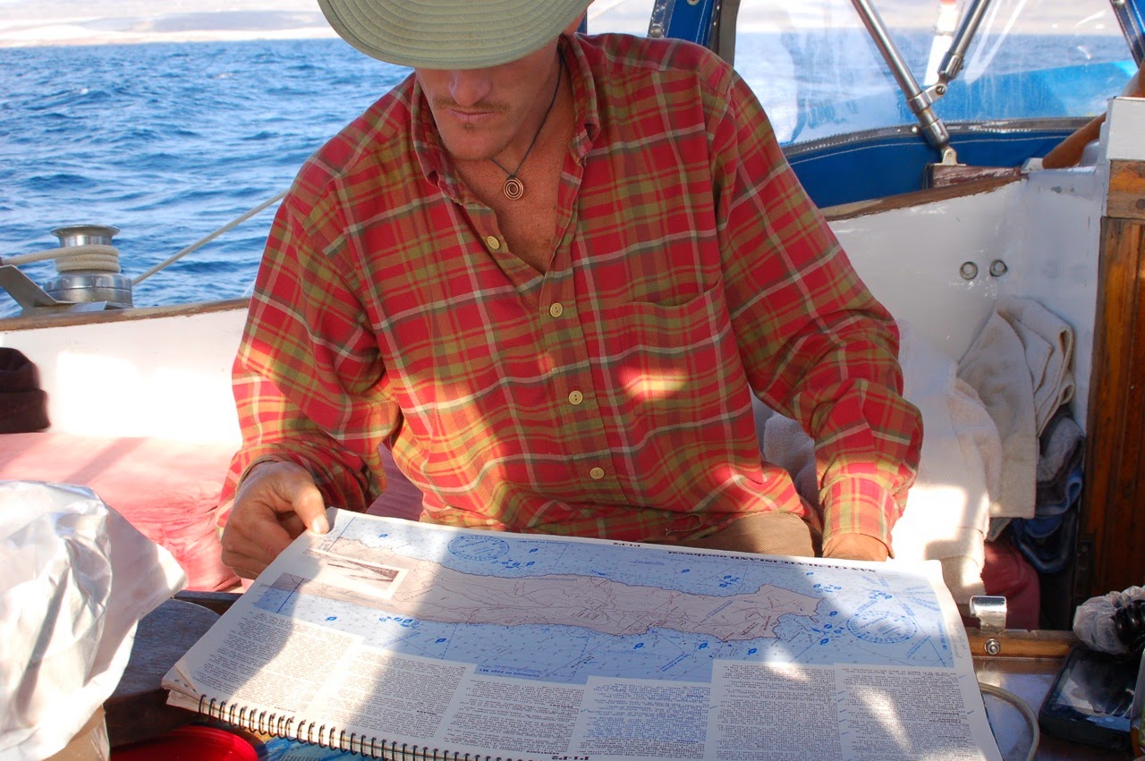
We investigated the chart. Should we go to the guaranteed anchorage at Pyramid Cove, 40nm away? Our friend had casually mentioned a cove on the exposed west side, about 32nm away. How bad could it be? The forecast called for moderate 15 knot NW winds. 

 It was a gamble. We'd arrive around sunset, so if it was a poor anchorage, we'd have to move in the dark. Not a great idea on our first visit. Would the Navy kick us out? I was totally unsure what would happen. 

 I really wanted to see all the sides of the island. Aldebaran is a solid boat, with strong anchor gear.  Our anchor windlass has been faulty, but I had 3 other crew to help. 

 We decided to take the chance and head to the west side and find the cove we had heard about.


Tuesday, November 5, 2013

Silver Canyon and the Missing Water Bottles


Silver Canyon

Appears a lot of people lost their plastic water bottles!

If you were one of them, you might want to look in Silver Canyon on the backside of Catalina.

Strange as it might be, this pristine, completely isolated beach is littered with plastic bottles, carried by the prevailing current and wind:

The "Catalina Eddy" effect.
Predominant NW wind flow spins around in the Southern California Bight.


The busy ports of Catalina were remarkably clean, 
despite the hoardes of people over the Buccaneer's weekend. So we were shocked when we sailed around the "remote", hardly visited South corner and came across piles of trash on the beach!

Collecting Bottles
The pygmy mammoth supervises the trash collection

We started picking up garbage. Action is a good remedy for this form of depression. We piled the bottles, styrofoam, and broken fishing rods into a handy City of Long Beach trash receptacle. We didn't feel great about ourselves, but we felt better.


Silver Canyon Pan
The Silver Canyon and Palisades, seemingly pristine.


What's up with our society's acceptance of waste?  It's absurd actually. Economic theory would suggest that "inefficiencies" should be reduced. One-time use plastic bottles are a ridiculous inefficiency.

Some of the resources wasted for a few gulps of water:

  1. plastic manufacture with petroleum or alternatives
  2. transportation with fossil fuel
  3. disposal on landfills
  4. water pollution affecting fish, sea birds, turtles, marine life in general; which we depend on for protein and countless benefits. 


What are some alternatives to plastic water bottles?

  • Britta water filters in the sink
  • Nalgene / Klean Kanteens. 
  • Sparkletts-type 5 gallons jugs of water, delivered to your home or refilled at 25 cents per gallon with reverse osmosis.
At the very least, make darn sure the plastic bottles get to the recycling center, if you must use the little devils.


From Little Harbor to Silver Canyon: about 8 nautical miles